
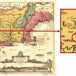
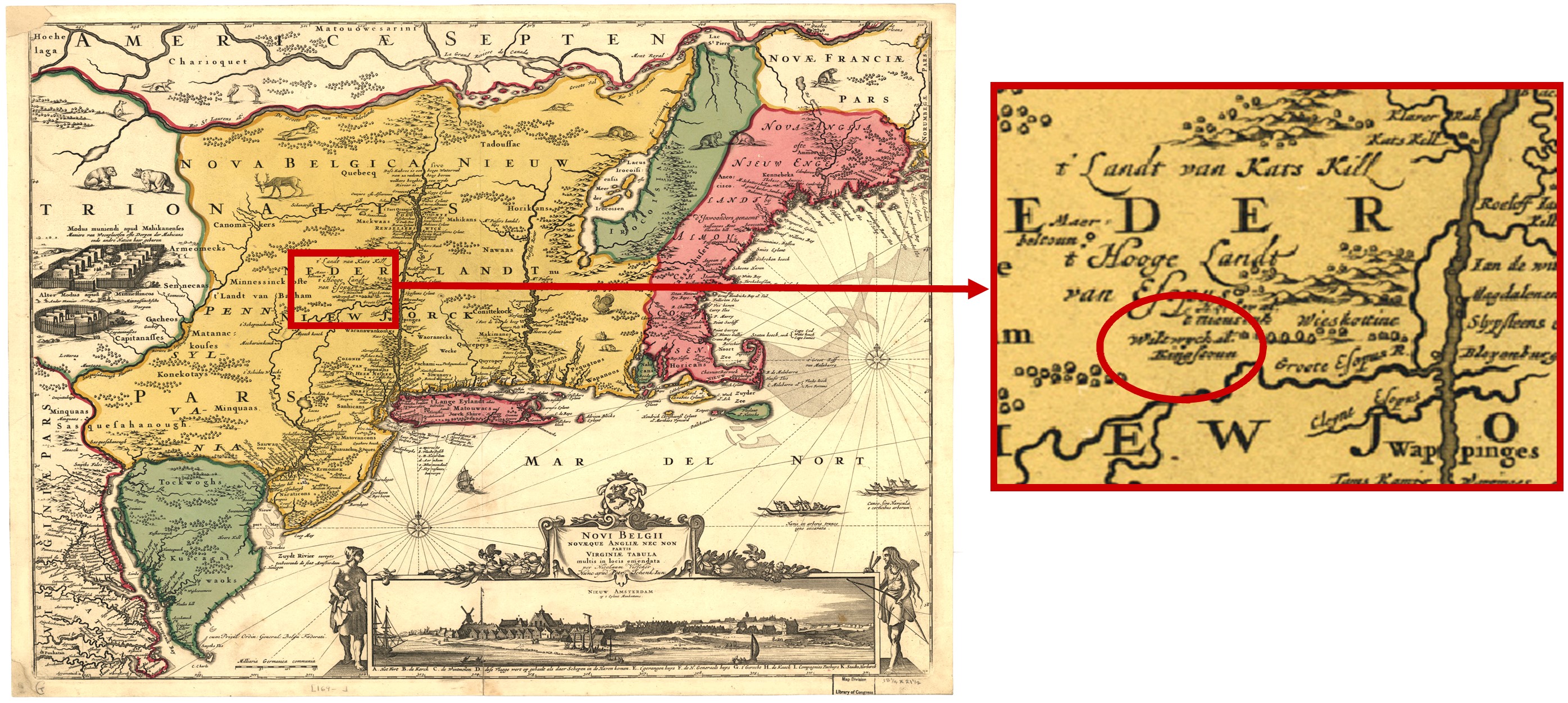
Wiltwyck was first settled in 1652 by settlers from Rennselaerswyck and Fort Orange (modern-day Albany). Wiltwyck was a part of the larger Dutch settlement called New Netherland. New Netherland can be found on the map above that was made by Nicholas Visscher in 1656. On the map and within the red circle is Wiltwyck. It is the 3rd oldest town in New York State after New Amsterdam (New York City) and Fort Orange (Albany).
Resource:
- Map of New Netherland and New England, and also parts of Virginia by Nicolaes Visscher, 1656, reprint 1685. Wikimedia Commons.
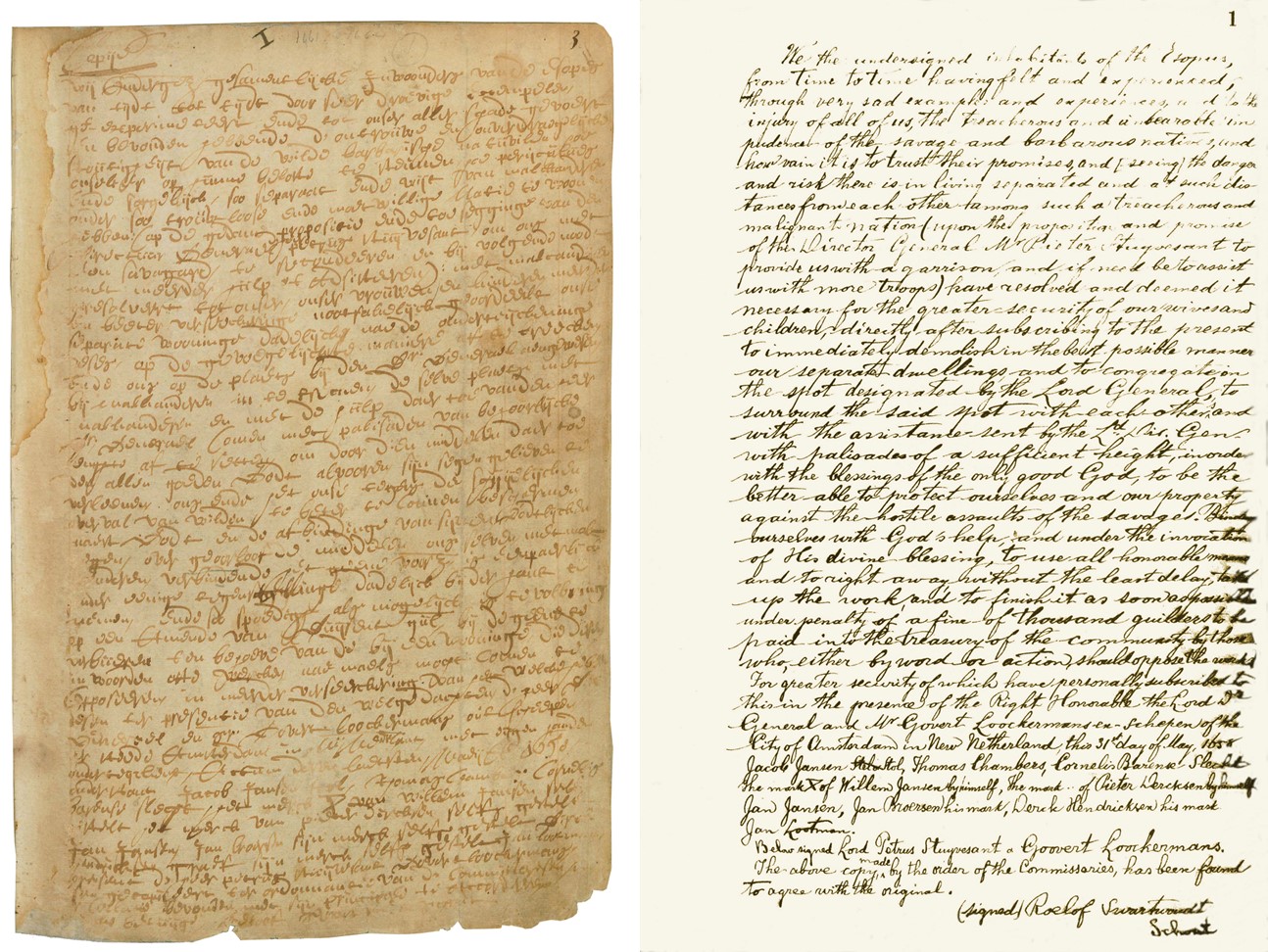
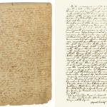
These first settlers lived along the Rondout and Esopus Creeks on separate farms. After some unrest with the local Native Americans, the Director General of the New Netherland Colony, Peter Stuyvesant ordered residents to abandon their homes, move to a defensible spot and surround it with a palisades which would form a fort. This order is dated May 31, 1658 and is referred to as the Stockade Bond because it authorized the construction of the stockade fence around part of Uptown Kingston.
Agreement to Build the Stockade, May 31, 1658 Transcription
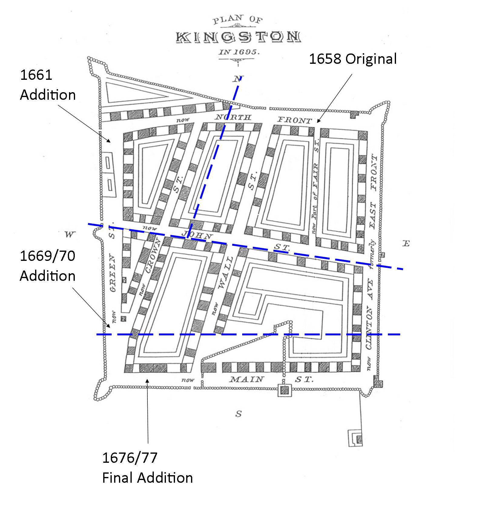
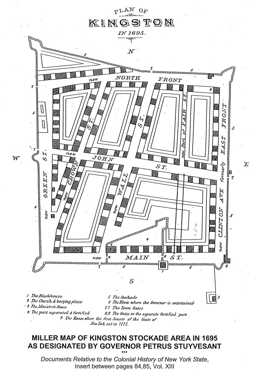
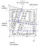
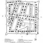
The settlers constructed the stockade and also constructed their new houses within the walls. Here, these new residents would live, work and play. Settlers continued to move to the newly formed village of Wiltwyck. As the population of this Dutch settlement grew so did the Stockade area. The Stockade underwent three expansions; the 1661 addition westward and two southerly additions in 1670 and 1677. It eventually looked as shown in the modified 1695 Plan of Kingston.
Image Adapted from:
- Brodhead, John Romeyn, et al. “Miller Map of Kingston Stockade Area in 1695 as Designated by Governor Petrus Stuyvesant.” Documents Relative to the Colonial History of the State of New-York : Procured in Holland, England, and France, Vol. XIII, Albany: Weed, Parsons, 1853.
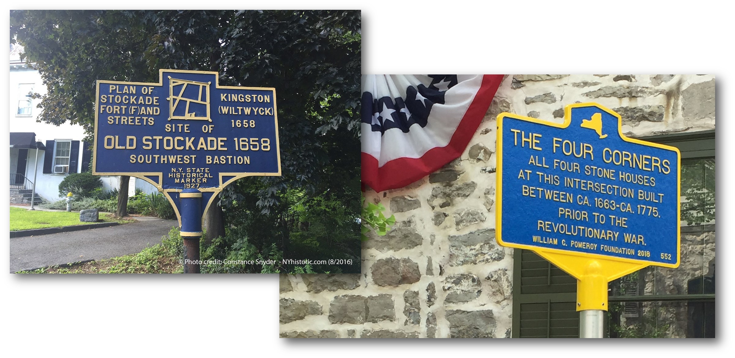
Wiltwyck is the only one of three original Dutch settlements in New York surrounded by stockades where the outline of the stockade is still evident due to the raised ground. Within the area are many historic buildings from the 17th, 18th and 19th centuries, including the Ulster County Courthouse, the Senate House where the state of New York was established in 1777, and the Old Dutch Church, a National Historic Landmark. Some survived the Burning of Kingston by British forces during the Revolutionary War. The intersection of Crown and John streets has Colonial-era Dutch stone houses on all four corners, all of which pre-date the Revolutionary War.
Resources:
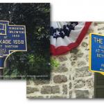
- Snyder, Constance. “Old Stockade, 1658, N.Y. State Historical Marker.” New York Historic, Aug. 2016, nyhistoric.com/2016/08/senate-house-state-historic-site/.
- Ulster County Clerk's Office. Four Corners Historic Marker. Kingston, NY, 8 June 2019.
From its founding in the mid-17th century to the creation of the modern city of Kingston in 1872, the history of the Stockade District is the history of Kingston. Most of its older buildings were restored and rebuilt in the years after the 1777 burning of the village by the British, and its historic character has been made diverse as significant buildings were erected throughout the 19th century.
The final layout of the original Stockade is shown in the Miller Map, which can be found in Volume 13 of Documents Relative to Colonial History of the State of New York. The map was designed by an Anglican Priest named John Miller in 1695. On his way back to England, Miller was captured by French Privateers, but managed to throw his notes overboard. After being paroled from the French, he returned to England and recreated the map from memory.
Resource:
Brodhead, John Romeyn, et al. “Miller Map of Kingston Stockade Area in 1695 as Designated by Governor Petrus Stuyvesant.” Documents Relative to the Colonial History of the State of New-York : Procured in Holland, England, and France, Vol. XIII, Albany: Weed, Parsons, 1853.
THE ULSTER COUNTY RECORDS CENTER
- 300 Foxhall Avenue, Kingston, NY 12401
- archives[at]co.ulster.ny[dot]us
- (845) 340-3415
- (845) 340-3418
OPEN MONDAY THROUGH FRIDAY, 9:00 AM - 4:45 PM
© 2026. THE ULSTER COUNTY CLERK’S OFFICE.